n easy out-and-back hike in Big Bend National Park and one of my favorite hikes full of geologic marvels that leads to the heart of Grapevine Hills: the geologic wonder all visitors come to see. Here, you’ll discover some of the most picturesque spots in the park, and once you reach Balanced Rock, the iconic views of Big Bend are spectacular. The beauty and wonder of this trail are an experience you do not want to miss.
In every walk with nature, one receives far more than he seeks. -John Muir
To get to Grapevine Hills Trail, I recommend a vehicle with high clearance, preferably with four-wheel-drive. You must travel down Grapevine Hills dirt road, a single-lane dirt road, for approximately six miles, which can be rough in areas with washboard, rough at the edges, and slow going even with the proper vehicle. If you do not have a high-clearance vehicle, drive slowly, take your time, and be cautious in navigating.
The trailhead is on the right and the parking area is a small gravel parking spot with limited parking, so if your vehicle is large, you may not find adequate space. During busy times, such as spring break, Thanksgiving, or Christmas, parking may be difficult to find.
When to Hike Grapevine Hills Trail
After a sweltering day of hiking, sometimes in 100-degree heat, we hit Grapevine Hills Trail for our last hike of the day before we headed back to Far Flung Outdoor Center, and I’m so pleased we did. It left me with some of my most precious memories from our visit to Big Bend National Park.
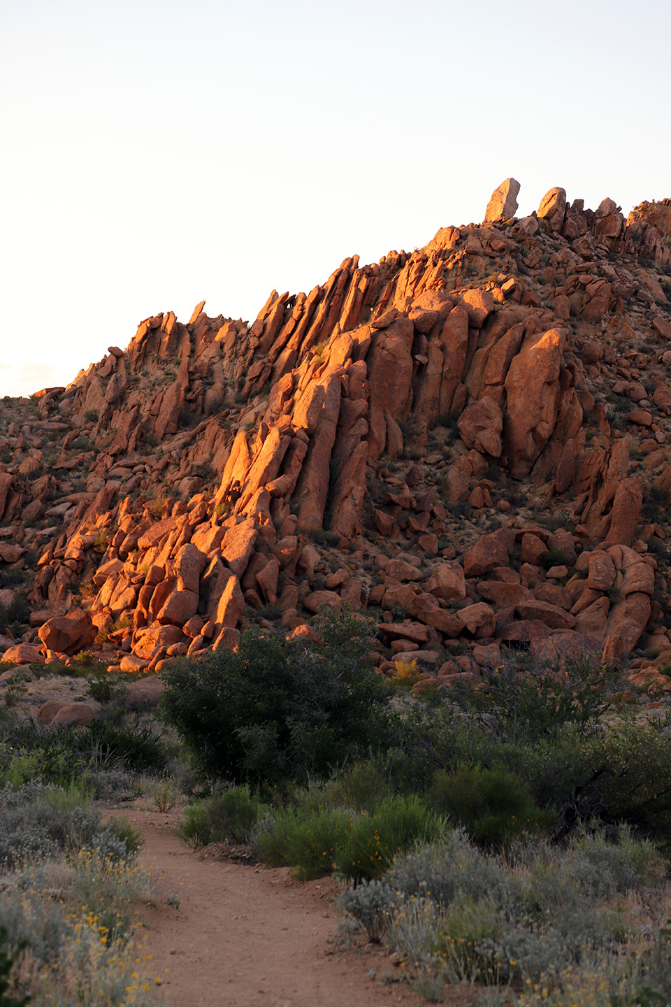
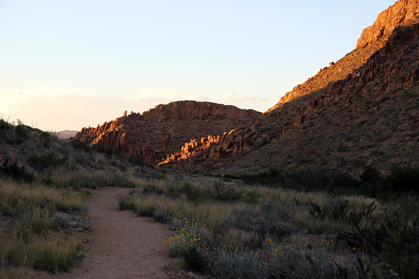
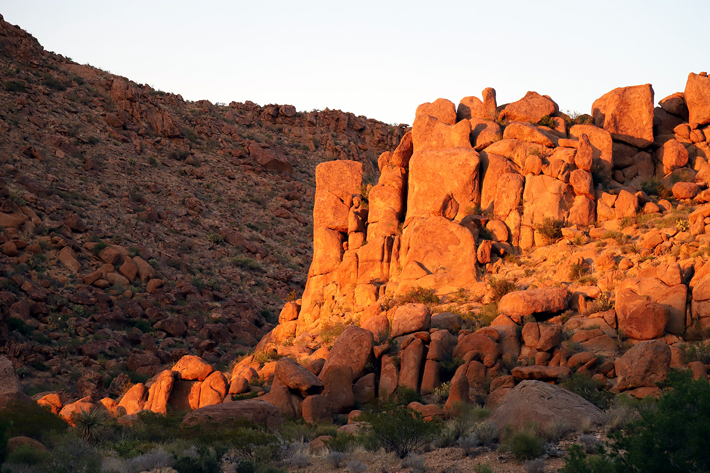
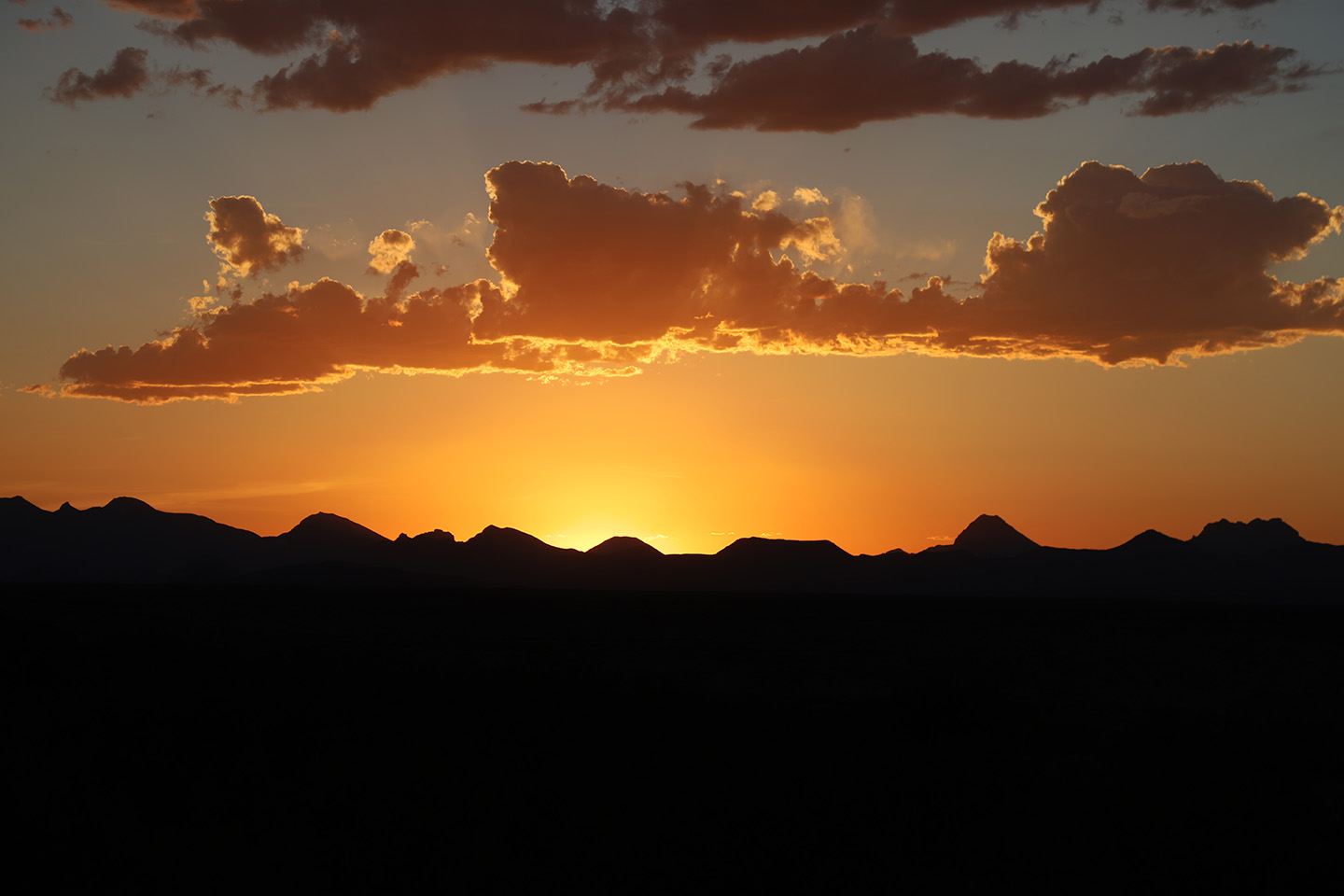
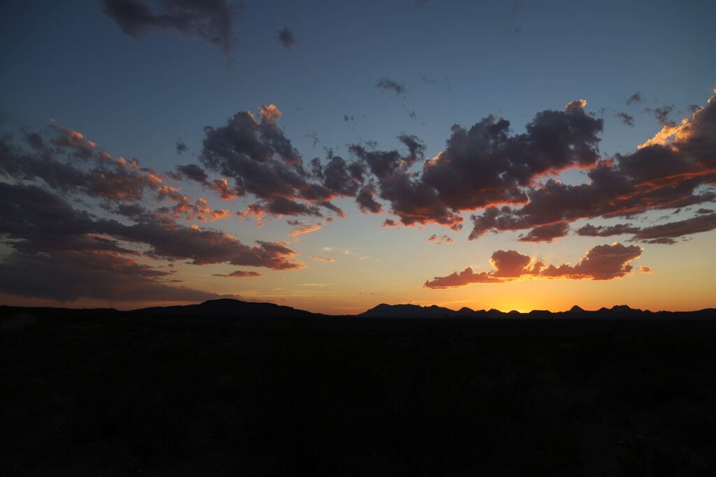
I recommend hiking this trail in the evening, saving time to head back toward sunset. It’s the perfect evening hike and an excellent way to end a day of adventure in the park. Heading back near sunset, you will experience a spectacular light show. The shifting shades of orange are magnificent, and you will never forget the magical orange glow illuminating the rocks. It’s an unforgettable experience. As you head back to the parking lot, the valley will grace you with impressive views and, on the horizon, you’re in for an astonishing sight as the sun sets and the clouds light up in a fiery glow.
This is a hot hike from April to September. It offers little shade, and there is not any water on the trail, so carry 1-2 liters of water per person. If you hike during the hot season, I highly recommend an early start or hit the trail right before the sun sets. If you hike just before sunset, be mindful of the time to avoid climbing down and walking back in the dark. Since this is a busy trail, hiking in the evening allows you to experience the trail when it’s not overly crowded.
History
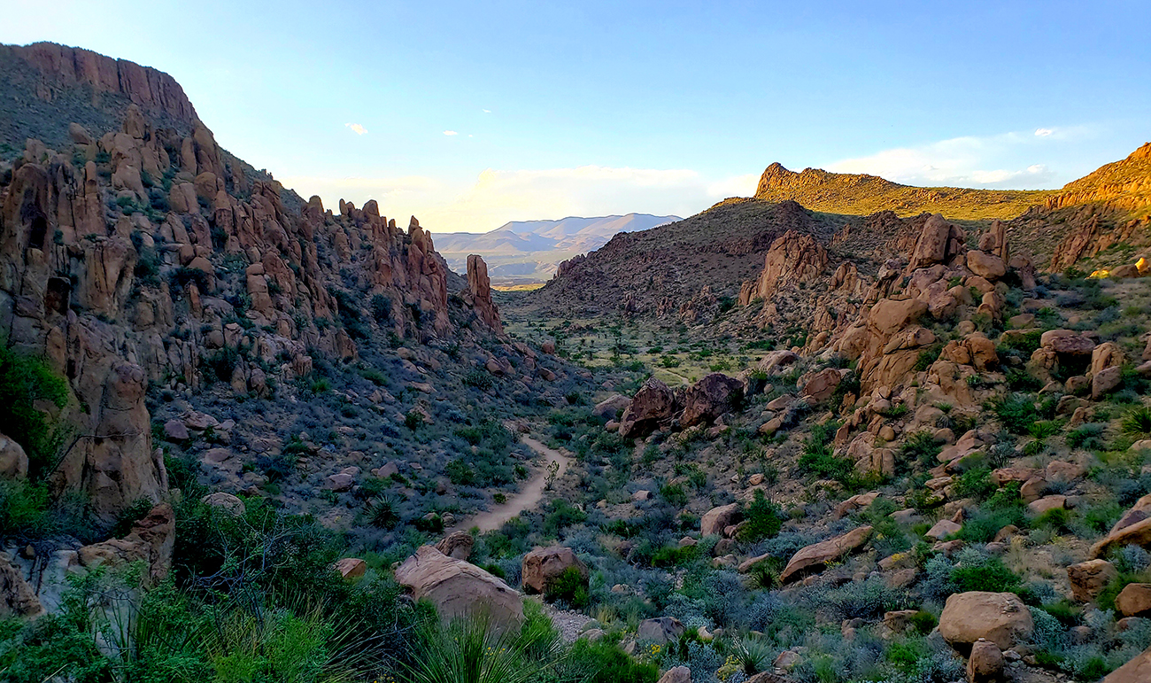
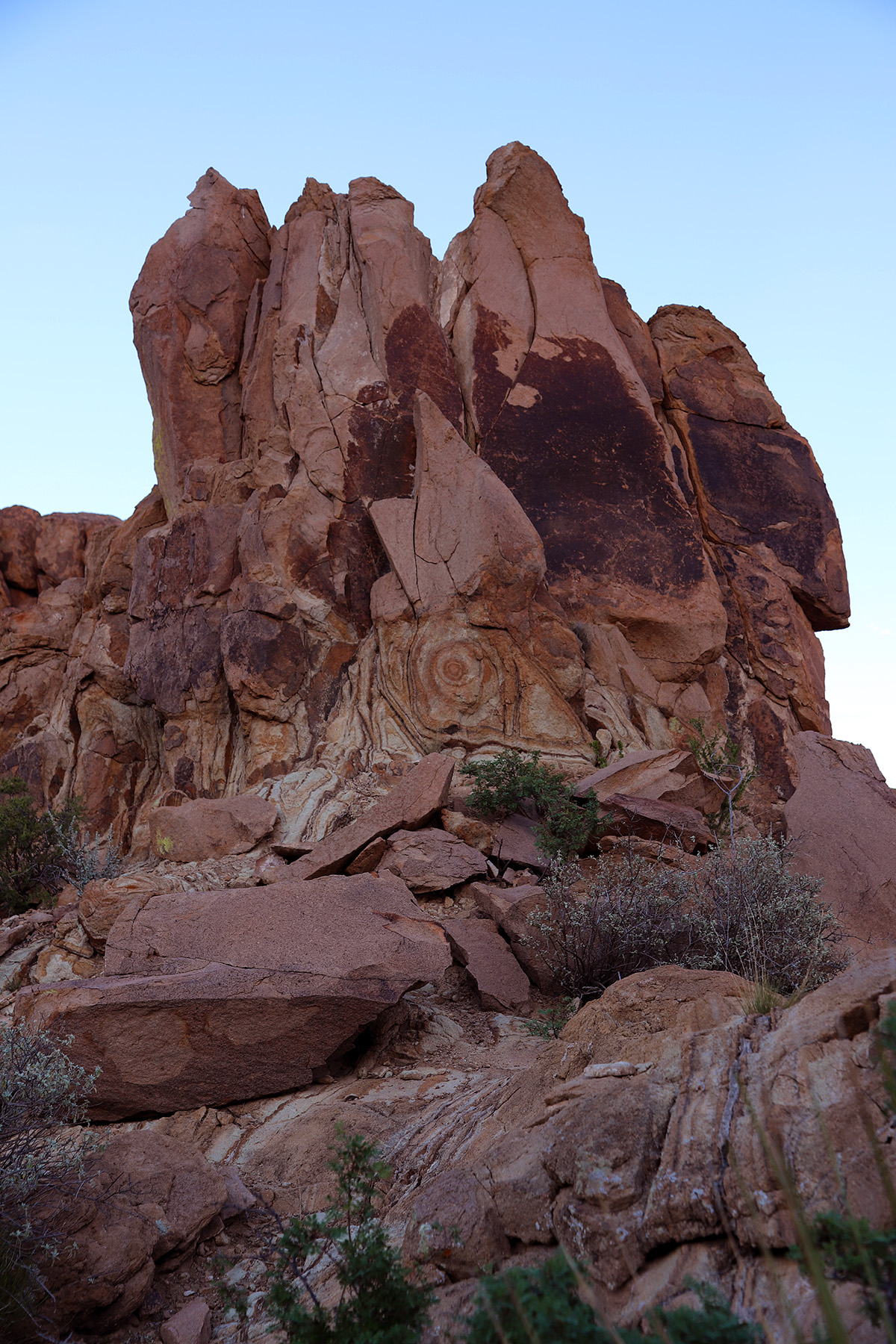
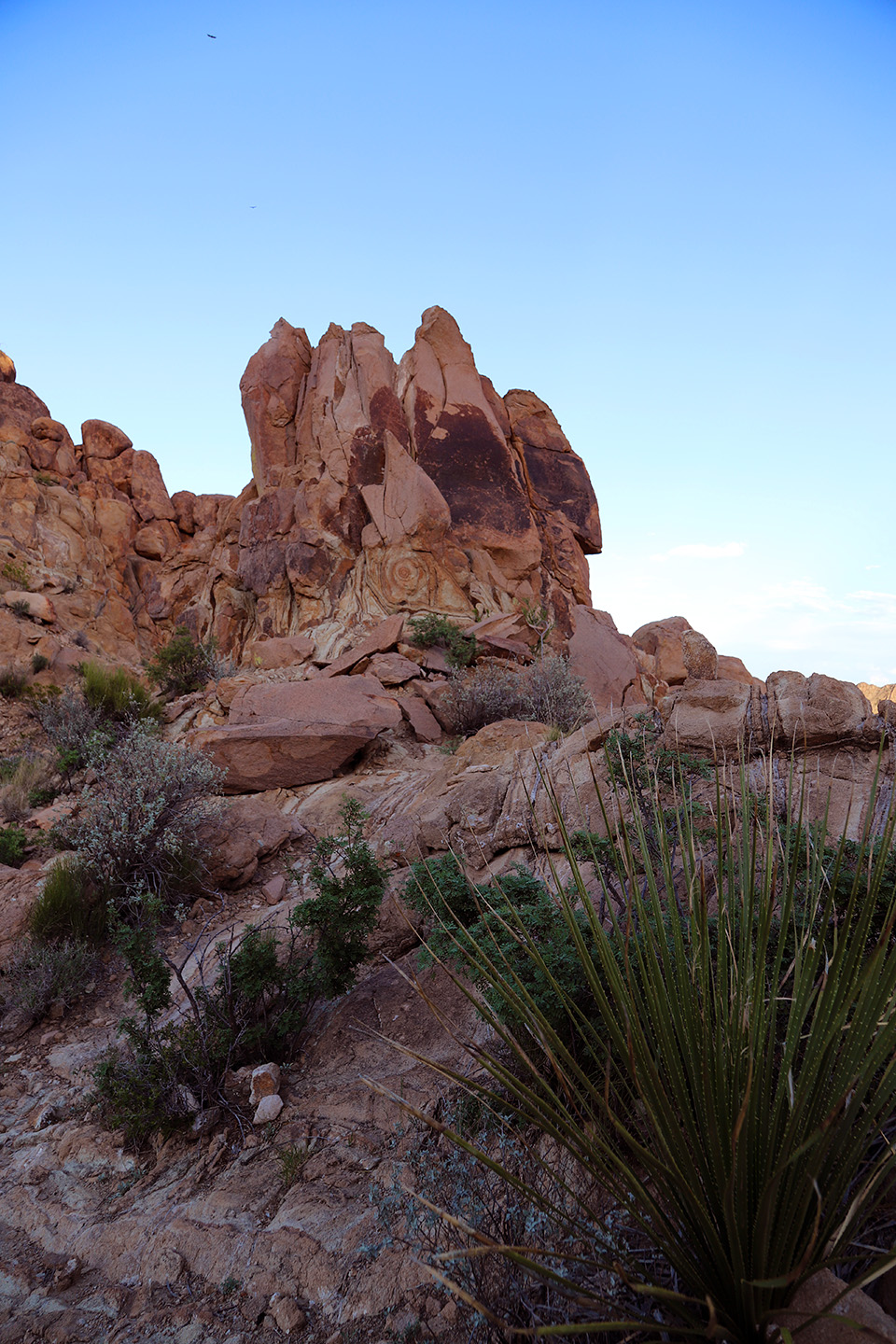
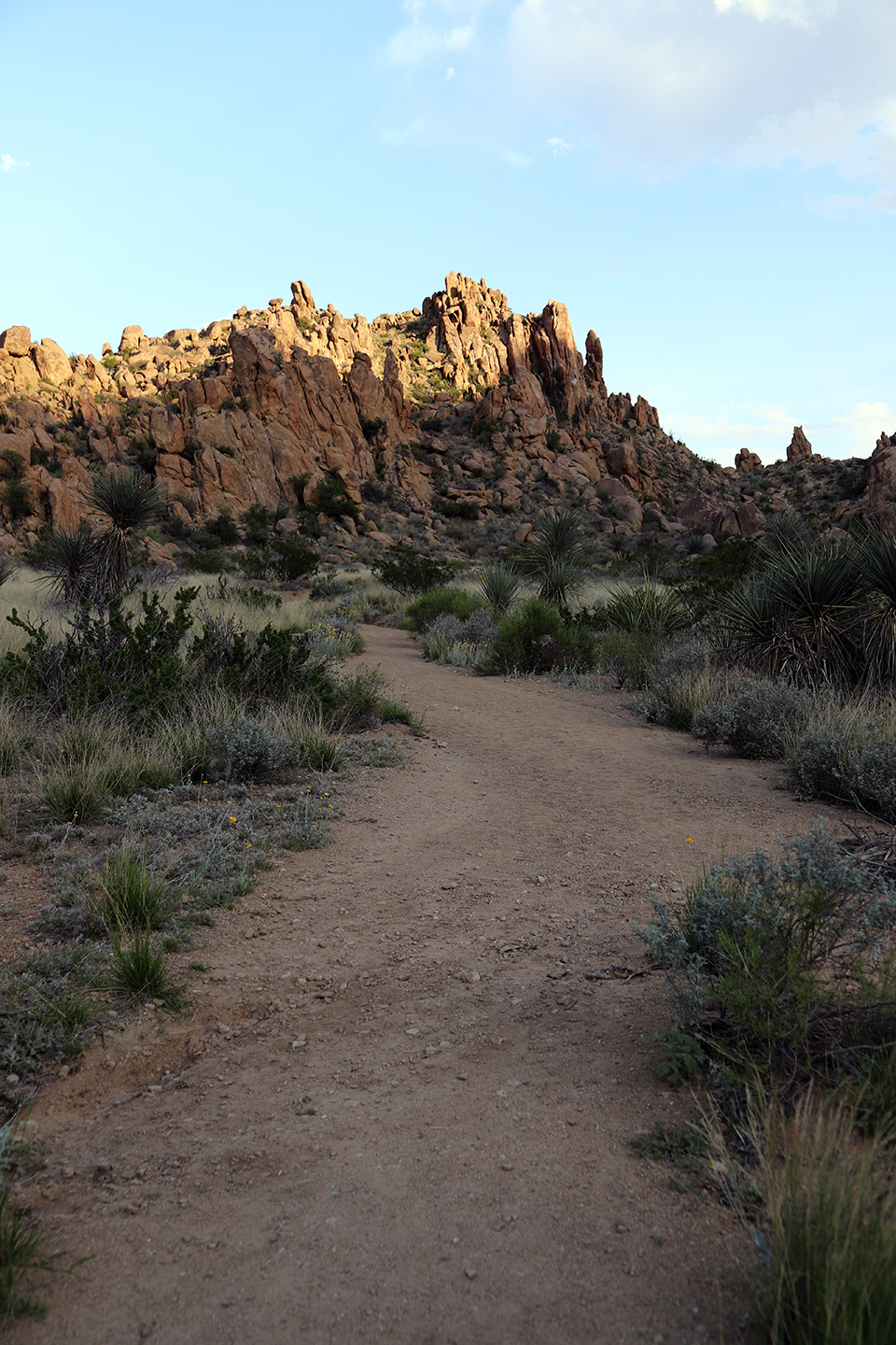
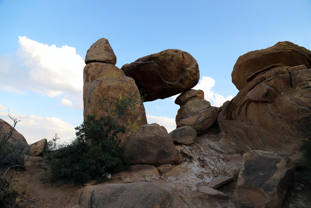
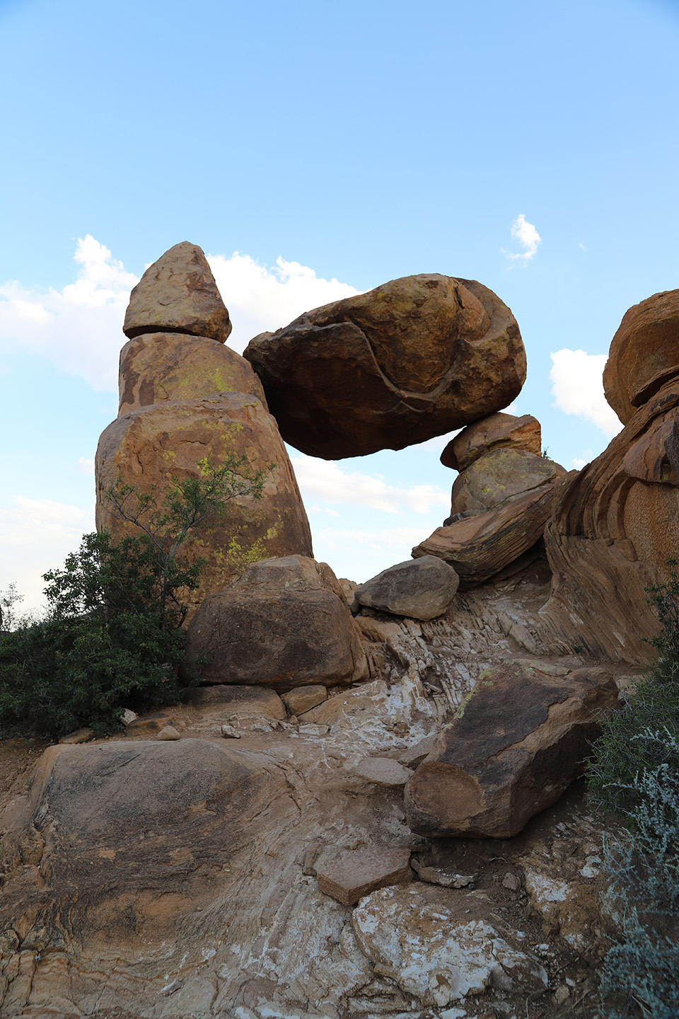
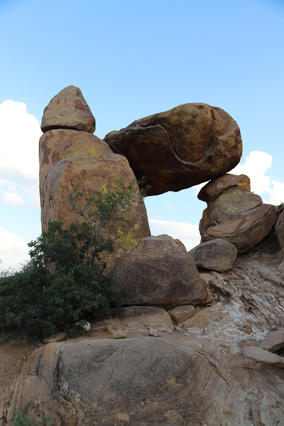
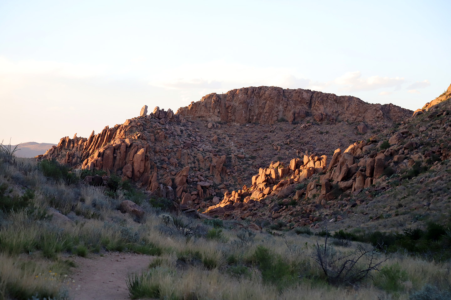
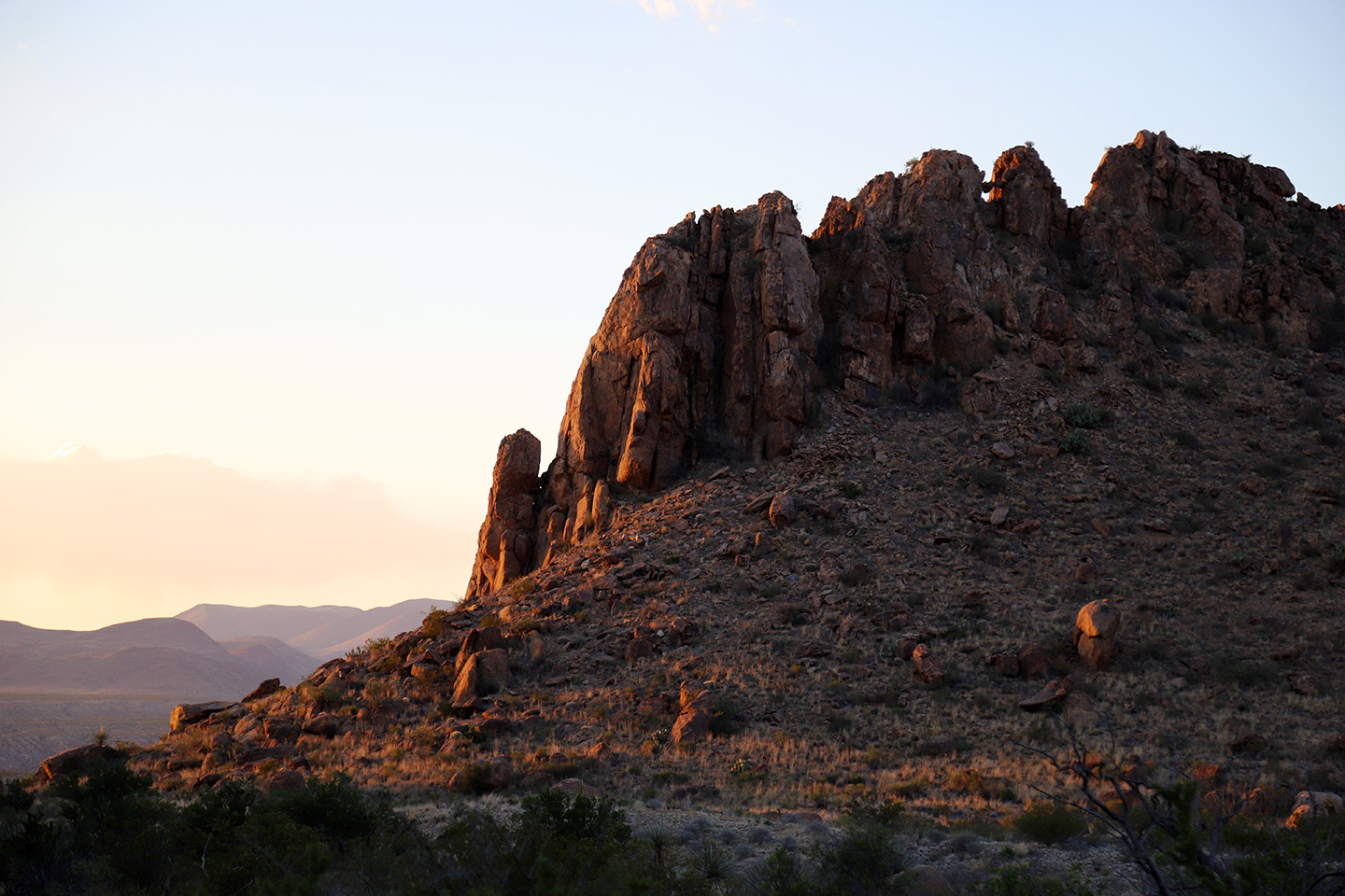
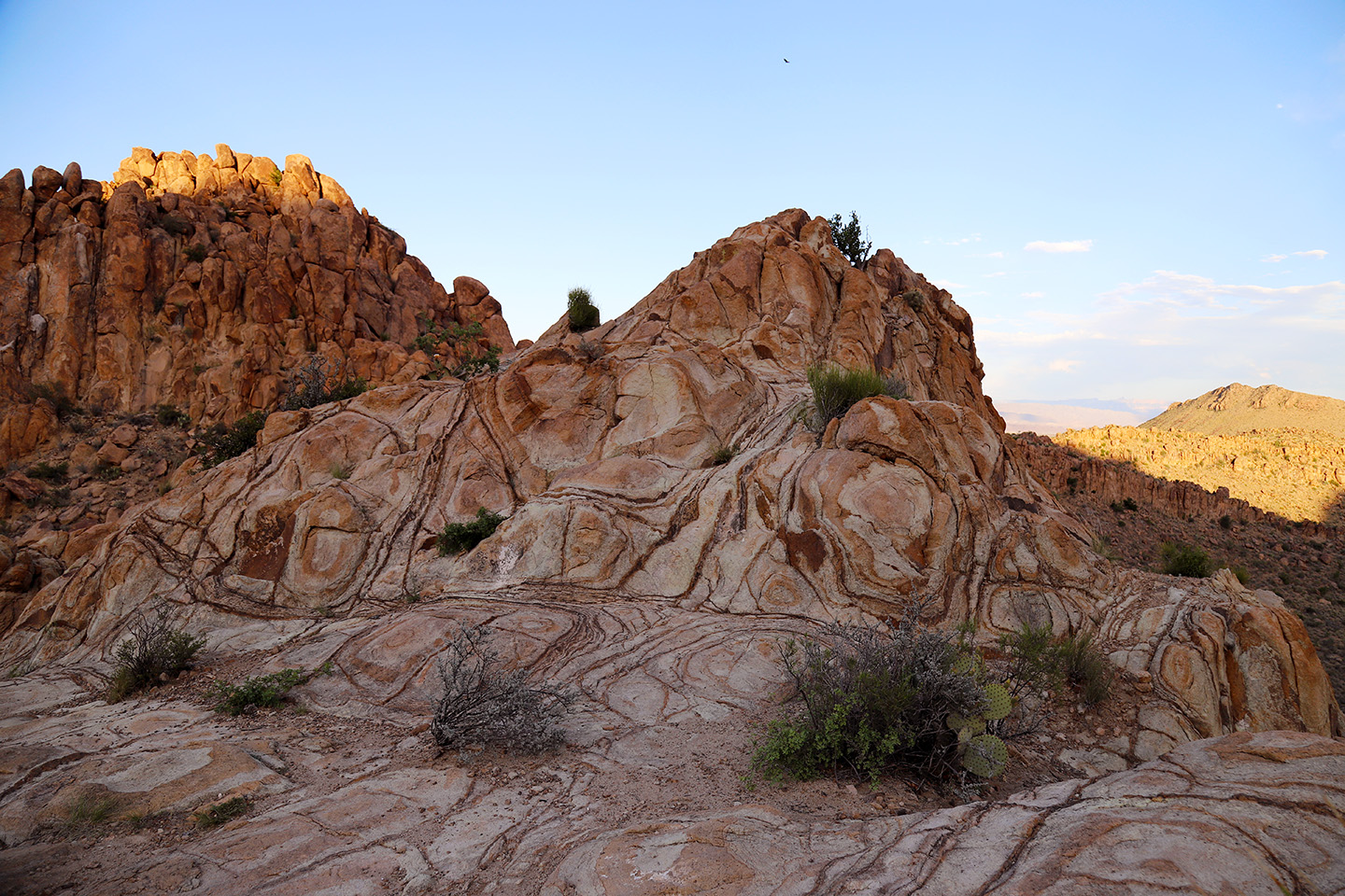
Grapevine Hill is a laccolith later exposed by erosion. Formed as the result of rising magma within the earth, becoming entrapped by overlying sedimentary rock layers, the Grapevine Hills display fantastically rounded granite-like boulders of all shapes and sizes. In certain circumstances, such as one near the end of the trail, boulders have oriented themselves, so they balance precariously on top of other rocks. It’s a cool sight. As you hike, be sure to note the wide variety of rock shapes and forms along the trail.
Hitting the Trail
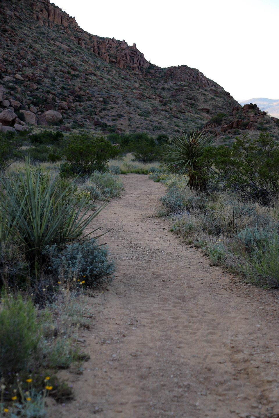
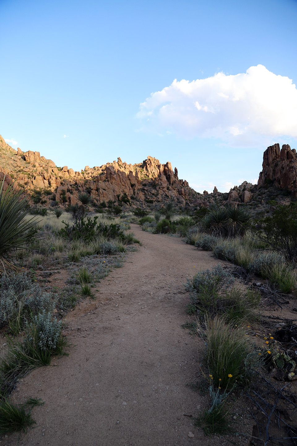
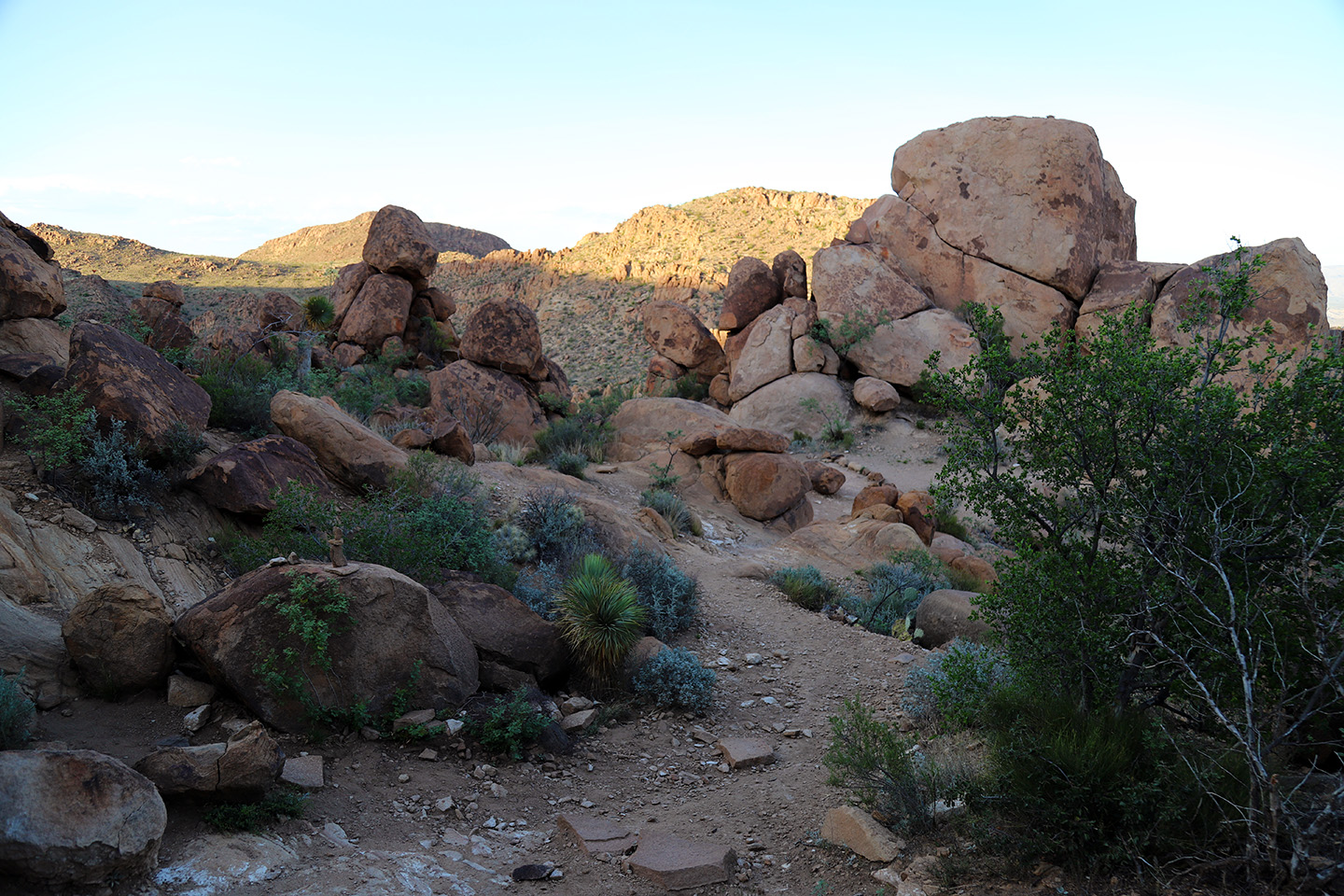
Starting at the Grapevine Hills Trail parking area, follow the trail southeast as it curves alongside a small, sandy wash into the small canyon. Follow the wash, climbing slightly until the trail leaves the wash behind and enters the geologic wonder of Grapevine Hills. As you hike, note the mesquite, cactus, yucca, and the beautiful rock formations that tower on both sides of the trail. Desert vegetation lines the wash in abundance and eroded rocks tower on both sides of the canyon. You will find yourself amazed by the geologic wonders you experience along the way.
Most of the trail follows a relatively flat terrain and is an easy 1-mile walk, which leads to a low pass at the south end of the drainage. For the first 0.75 miles, you’ll follow a sandy wash with a gradual gain in elevation. The last 0.25 miles, the trail is more difficult as it climbs a short, but steep, rocky slope before ending at Balanced Rock. Climb the ridge and traverse to the right to discover Balanced Rock.
Wildlife
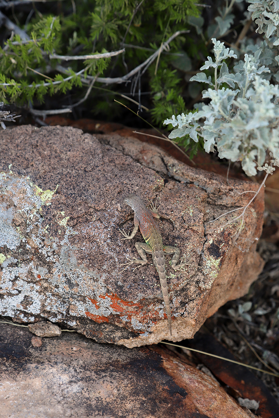
The trail is a goldmine for the lizard enthusiasts. You’ll discover many lizards all along the trail, darting over the path or perched on a rock with their head cocked to the side, studying you. We encountered many southwestern earless lizards, which I found amusing. They scuttled across our path and kept us company the entire way. I cannot say I’ve ever seen so many lizards in one location. The lizards entertained us as we made our way up the path and gave us optimal opportunities to observe them in their world and take photos.
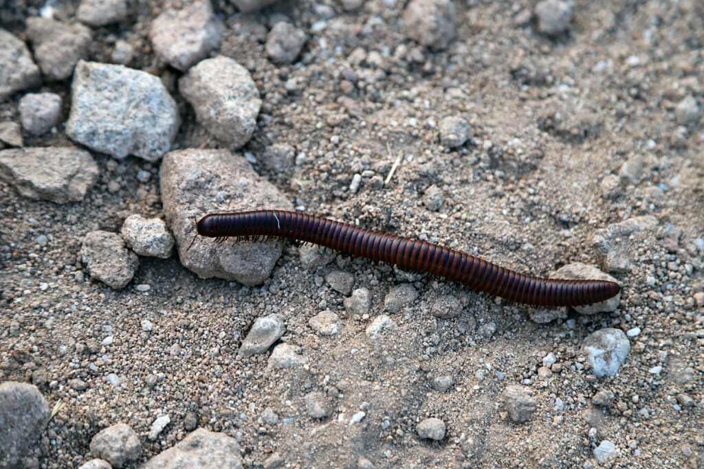
We also came across an 8-inch desert millipede, which was another amazing experience. One just doesn’t find the desert millipede anywhere, so we felt fortune for the encounter. The auburn-colored millipedes are big, super cool, and fun to watch. They are harmless to humans unless handled or eaten, at which time they might release a noxious irritant, so respect their space.
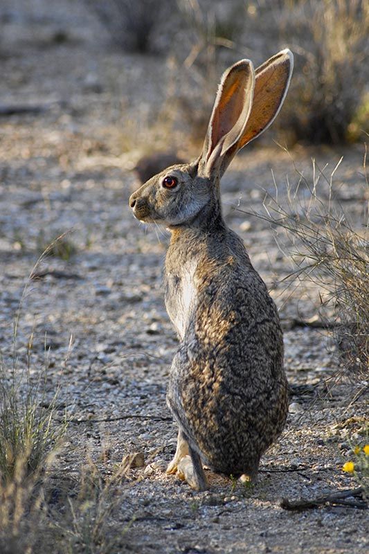
After our hike, as we made our way back to Terlingua, dozens of desert cottontails and black-tailed jackrabbits appeared along Grapevine Hills Road. We had to take care driving back as to the hares and rabbits consistently darted across our path and in front of the Jeep. Grapevine Hills offers a terrific opportunity to observe many cottontail rabbits and jackrabbits.
Balanced Rock
At the end of the canyon, you’ll discover the climb for Balanced Rock, the final destination of the trail for most. Balanced Rock is a boulder balanced and suspended overhead by two other rocks, creating a window underneath. It’s an impressive rock formation and you can expect remarkable views once you reach the top. The most prominent feature you will see is Nugent Mountain, which is about 10 miles away. Balanced Rock is at the end of the trail, and to return to the parking lot, retrace your step carefully. It’s easy to get confused on the way back down the rocks.
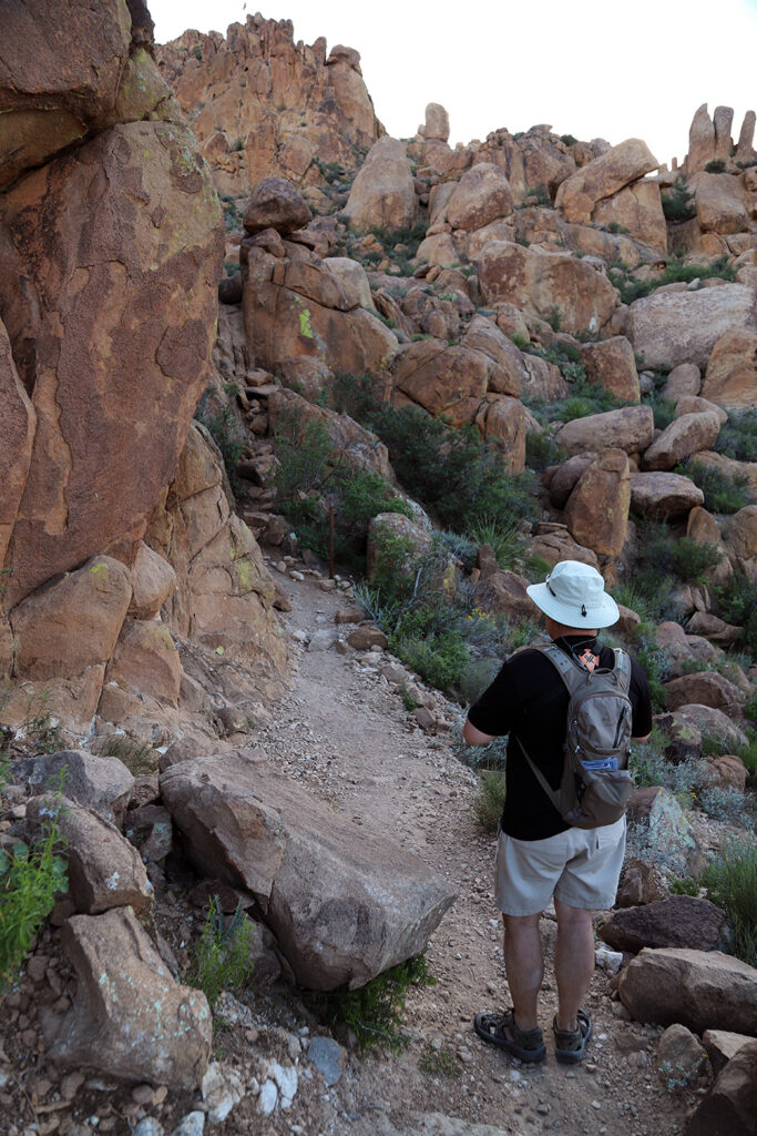
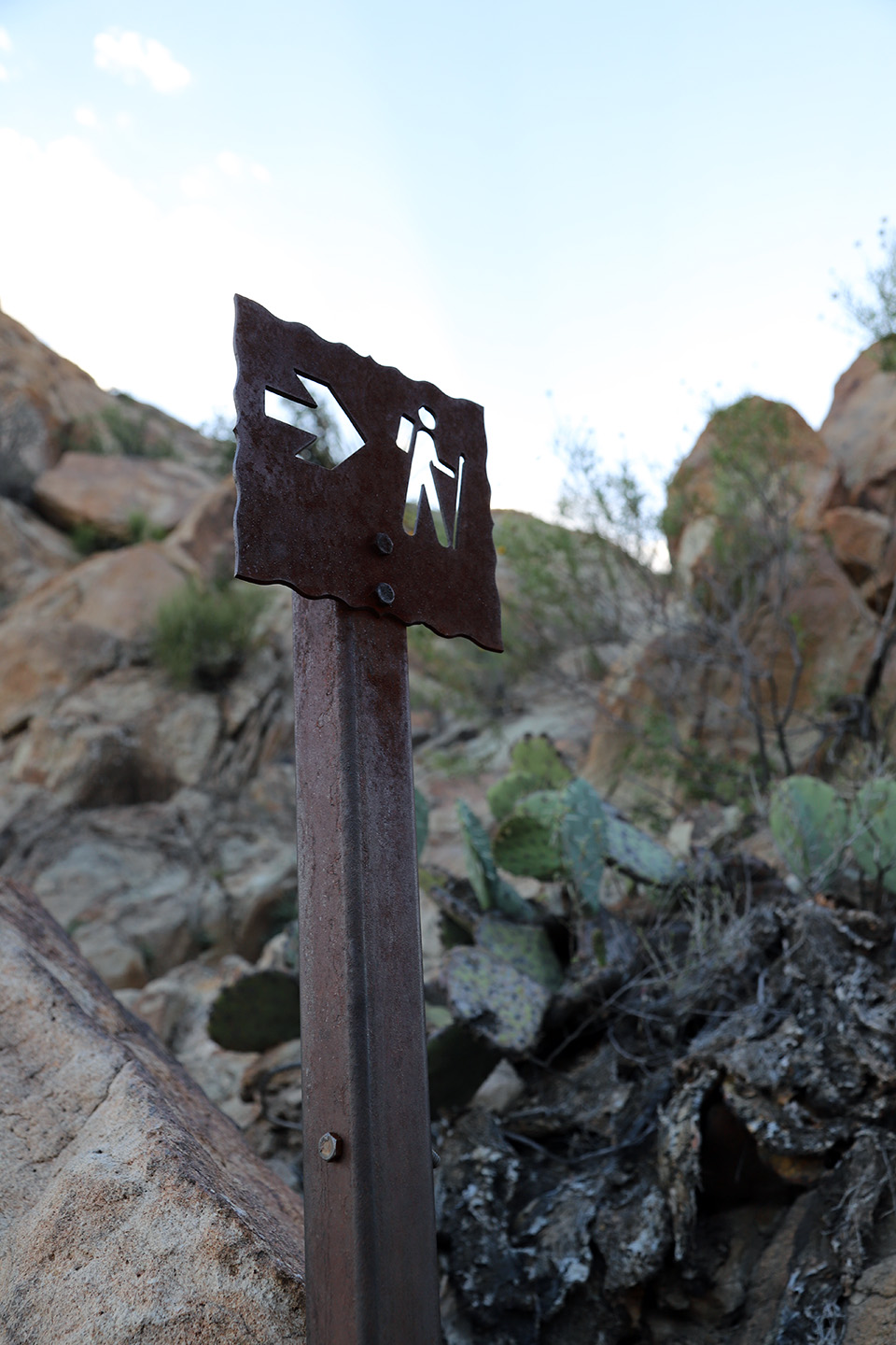
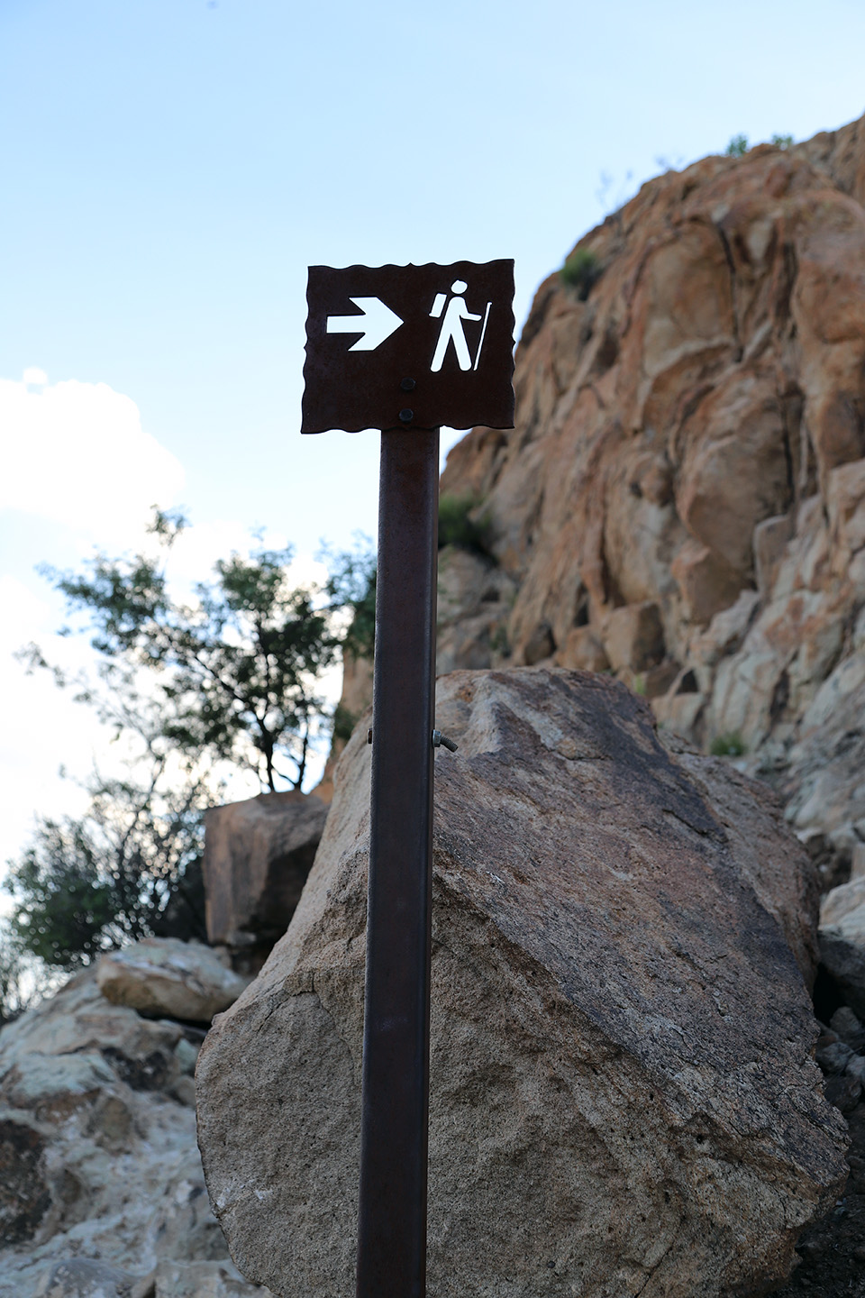
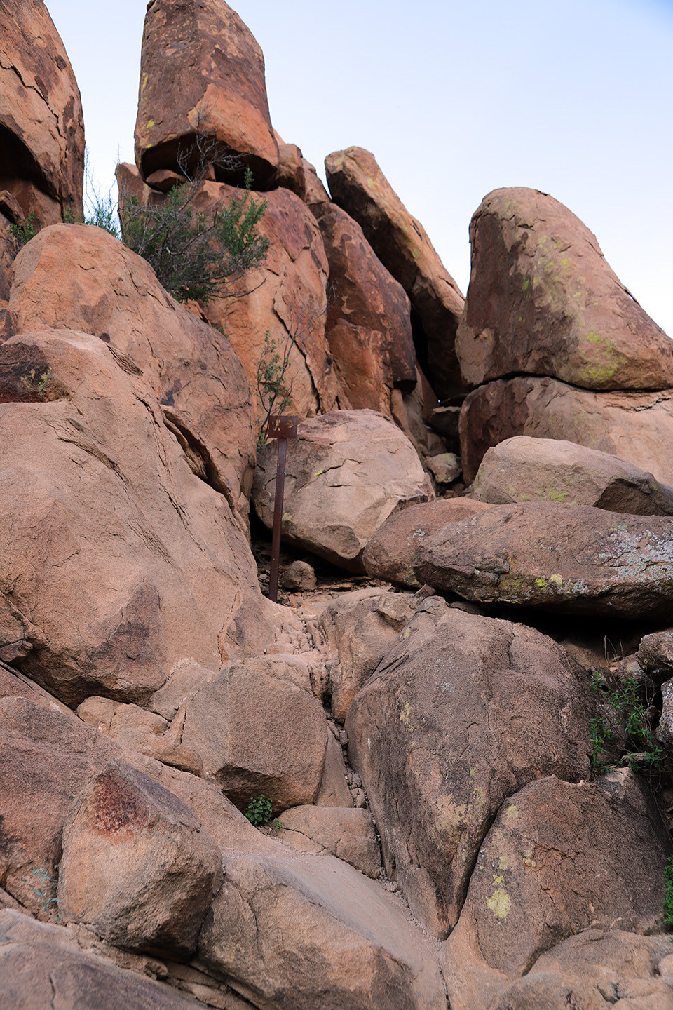
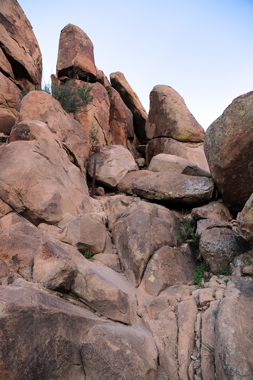
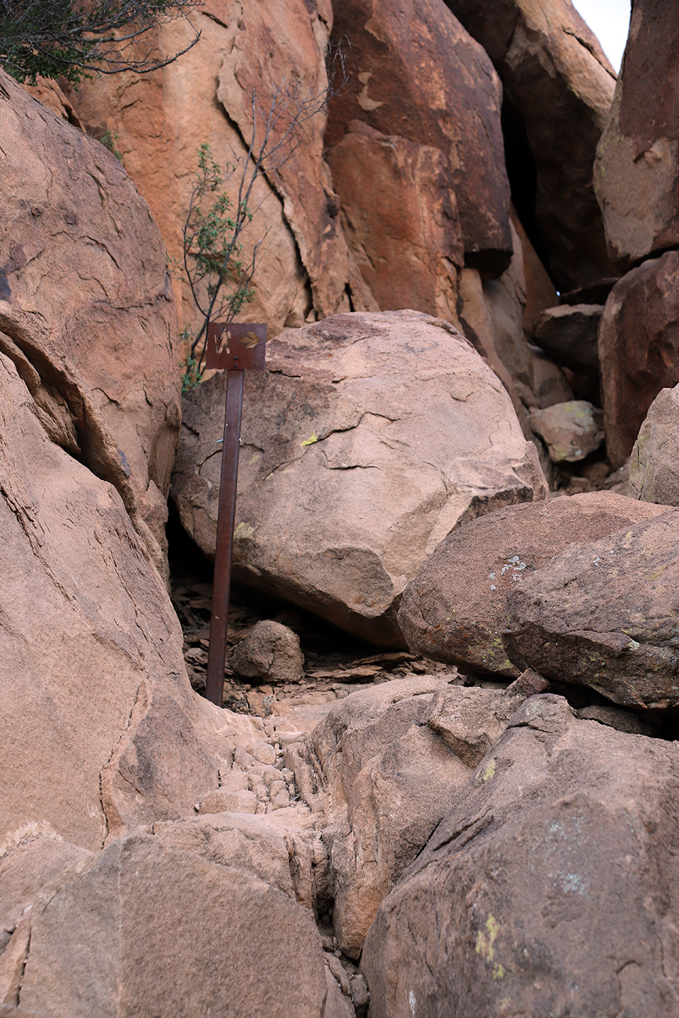
As you approach Balanced Rock, the terrain becomes rockier underfoot and there is a strenuous climb into the rock outcropping to reach Balanced Rock. Here, the trail is not well-marked, and you must pay attention to the path you need to follow because it can seem to disappear. The trail winds through rock formations and can be confusing. Watch for small signs and metal fence posts to guide you. Before we hiked this trail, I researched the climb to Balanced Rock, but found little information. I wish I had known more about the climb to the top. I had no idea the trail almost vanished into a wall of boulders and seemed to dissolve right before me. I felt somewhat unprepared because of this, but we found our way to the top.
Markers guide you as you climb up to Balanced Rock. Keep your eye on the path. It’s easy to lose the trail once you begin the climb.
It’s a steep climb through the rocks and more strenuous, so be prepared and expect a climb. In some areas, it may be necessary to use both your hands and feet to make it up the rocks, so this last section of the trail can be tricky if you have any mobility issues. Stay on the proper path, which can be a little tricky to follow not only on the way up, but on the way down as well. It’s important to pay close attention to your surroundings. It’s more difficult to find your way back down than it is to find your way up to Balanced Rock. Be sure to watch out for snakes, as they love to hide in the shady spots between the rocks and the terrain is an ideal environment for them. We never came across any snakes, but always be on guard in this terrain.
Once you reach the top, you’ll discover breathtaking views, geologic wonders, and lots of lizards.
Headed Back
As you head back and climb down from Balanced Rock, be sure to be aware of your surroundings and mindful of your path, so you don’t get lost. The terrain can disorientate you on the way back and the trail truly seems to disappear on the way down.
Once you climb down the rocks and reach the wash, if it’s near sunset, you’ll be in for an unbelievable light show. Enjoy the walk back to your vehicle and keep your eyes open for wildlife.
In the End
It’s a short hike, but one I highly recommend for the views and experience. The climb to Balanced Rock may be tricky for some, but it’s so worth it. You’ll see lots of lizards and discover amazing geologic wonders. Grapevine Hills Trail left me with some of my most favorite memories from Big Bend National Park. And the sunsets are breathtaking!
Quick Facts
No pets or bicycles on any trails.
No campfires.
No camping.
No collecting or possessing plants, animals, minerals, or artifacts.
Pack out your trash.
Do not approach or feed wildlife.
Smoking permitted in areas with sparse vegetation.
There’s no shade
Part of the trail is a rocky scramble to reach Balanced Rock
Climbing is required at the end of the trail.
Trail Safety
Bring plenty of water; a minimum of 1-2 liters per person.
Wear protective clothing like sun hats and long sleeves.
Pay attention to creek bed crossings and trail signs to avoid getting lost.
Be mindful of the path on the hike up to Balanced Rock and on your way back, so you don’t lose the trail.
I recommend hiking this trail in the early morning or evening. It’s too hot for a daytime hike. If you hike the trail toward the end of the day, you’ll be rewarded with a magnificent sunset and lighting, and you won’t have the sun blazing down on you.
Directions to the Trailhead
Leaving Panther Junction, the park headquarters, take a left out of the parking lot. Then, take a right onto Grapevine Hills Road, which is the first dirt road on the right, just after the turnoff to Chisos Basin.
The trailhead is approximately six and a half miles down Grapevine Hills Road, which is a maintained dirt road. Again, I recommend a high-clearance vehicle for this adventure. You will arrive at a small parking area, which is generally busy, and the trailhead is to the right.
Hiking Grapevine Hills Trail
Pros: Breathtaking views, incredible rock formations.
Cons: Hot to hike mid-day or during summer. Climb to Balance Rock can be difficult for some people.