The short and memorable hike to Woodbine Falls is one of my favorites when I am in the Absaroka-Beartooth Wilderness. The waterfall is easy to access, and at 1.6 miles round trip with about 345 feet in elevation gain, the beautiful out-and-back trail is great for all skill levels; small children, the elderly, and beginner hikers. It’s great for the entire family and since it’s a short hike, one has plenty of time to hike another trailhead, wander over to hike to Sioux Charley Lake, or journey over to Red Lodge for the rest of the day.
Witness Woodbine Falls thunder 300’ down steep, rocky cliffs.
Woodbine Falls Trail is an off-the-beaten path excursion in a quiet and less-visited part of the state, so it doesn’t attract too many visitors like Yellowstone or Glacier. Here you don’t have to deal with the crowds and stress like one does in the parks. This alone adds to the pleasure of the hike and witnessing the falls.
However, there can be a heavy usage for the area, but nothing compared to the National Parks. It’s a popular day hike for people who camp at Woodbine Campground. I’ve had occasions where I encountered many people during my hike, and I’ve had other experiences when I saw no one. The experience is variable, depending on the day, time, and season you visit.
My favorite time to hike this trail is in spring when the water level is high from the melt and the waterfall flows in full force. Also, in early spring, the trail is not so crowded, and you are more likely to have the trail to yourself. I have visited the falls in the winter and thoroughly enjoyed that experience. It’s a different world in the winter, and the humbling silence reminds you of all the wonder and beauty of Mother Nature.
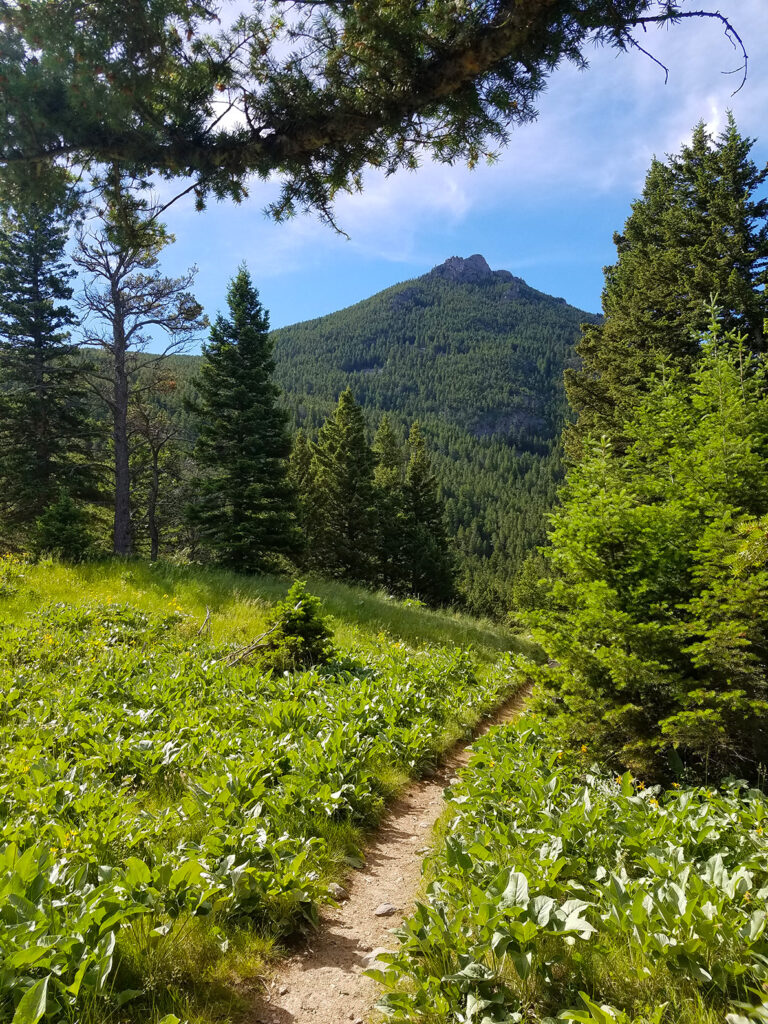
The trail begins at the Woodbine Campground near Nye, MT. Once you leave the meadow of the campground, you will follow a well-maintained path to the falls. After you cross a footbridge over Woodbine Creek, the trail comprises winding switchbacks along the stream, making the hike easier with the gradual change in elevation.
The trail will lead you through a diverse forest, including Douglas fir, Ponderosa pine, lodgepole pine, Rocky Mountain juniper, and others. The clearings host grasses, blooms, and flower-laden meadows. While you hike, you will discover an array of wildflowers, depending on the time of year, and vegetation. Stop and take-in the beauty of the flowers and the lush meadows. There is so much to discover on the trail.
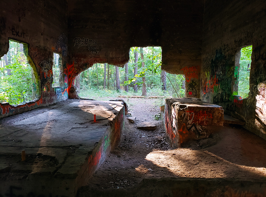
The Trail
Woodbine Falls Trail. Photo: Danny Johns
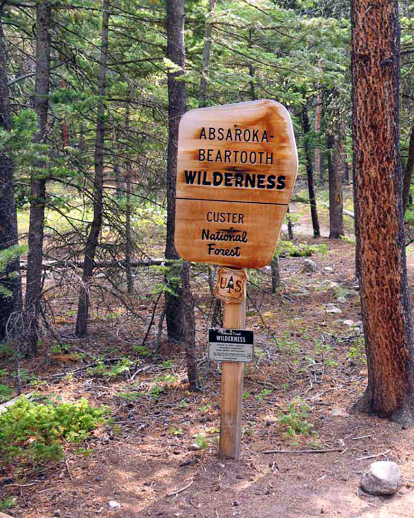
As you make your way toward the falls, the forest thickens into stands of lodgepole pine. When you pass the sign that marks the entrance for the Absaroka-Beartooth Wilderness, you will hear the thunder of the falls.
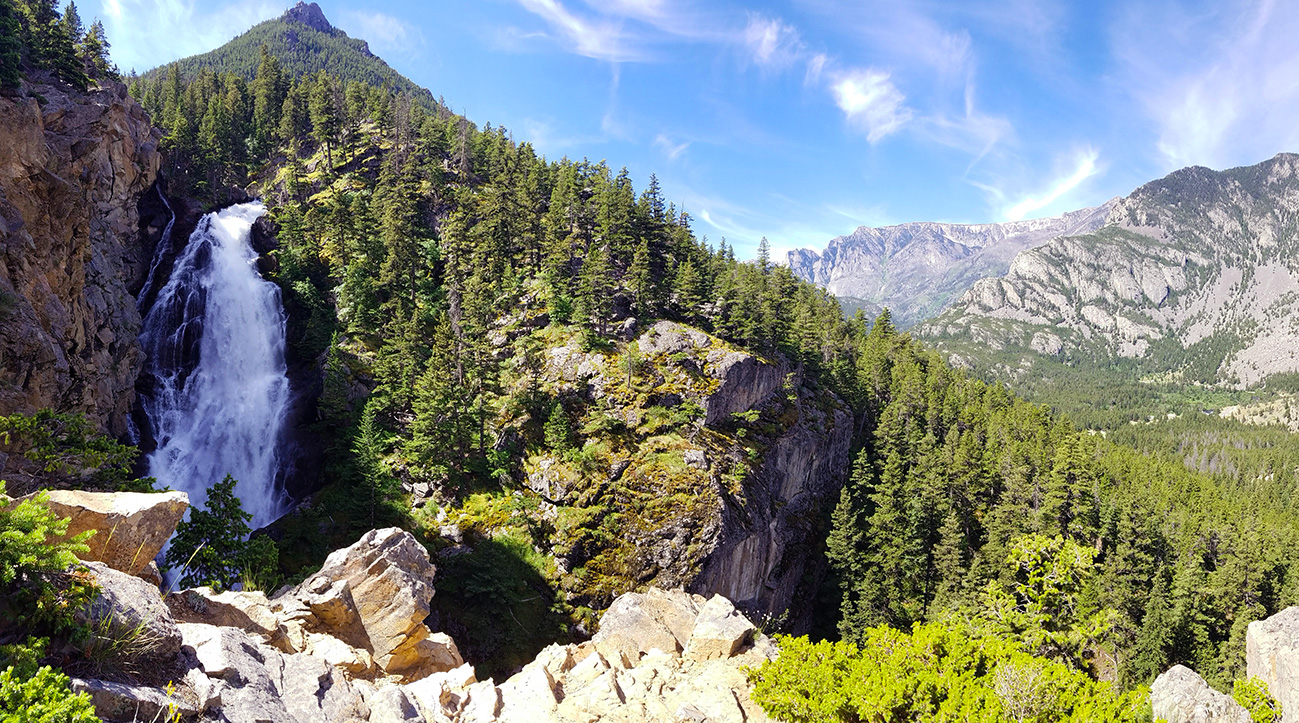
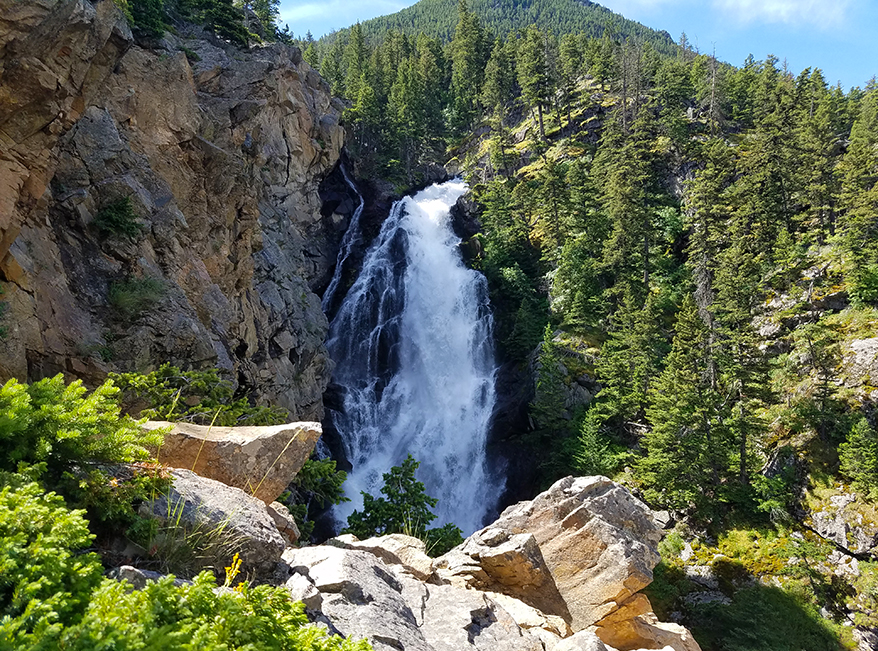
An overlook ends the trail, and the rock outcrop allows one an excellent view of the falls. Listen to the roar of tumbling water and witness Woodbine Falls thunder 280 feet down steep, rocky cliffs. Soak in your world. It’s a beautiful experience.
The hike ends with an incredible view: an impressive 280-foot-tall cascade drops into a ravine, which flows into Woodbine Creek and heads to join the Stillwater River. Be sure to view the canyon and the parking lot from this vantage point. It’s a spectacular view.
The Falls
Although the trail ends at the overlook, one can continue and climb to the top of the falls. If you have the energy, I recommend the climb. The views are stunning. There is no trail, but a worn path over the rocks takes you to the top. Please note, the climb isn’t for everyone. It gets difficult and one must be cautious. It’s important to wear proper shoes.
Before you head back, enjoy the spectacular views, listen to the roar of the falls, and breathe in that fresh mountain air.
Quick Facts
The trail is primarily used for hiking, walking, and nature trips and is best used from May until October.
Dogs can use the trail but must be kept on a leash.
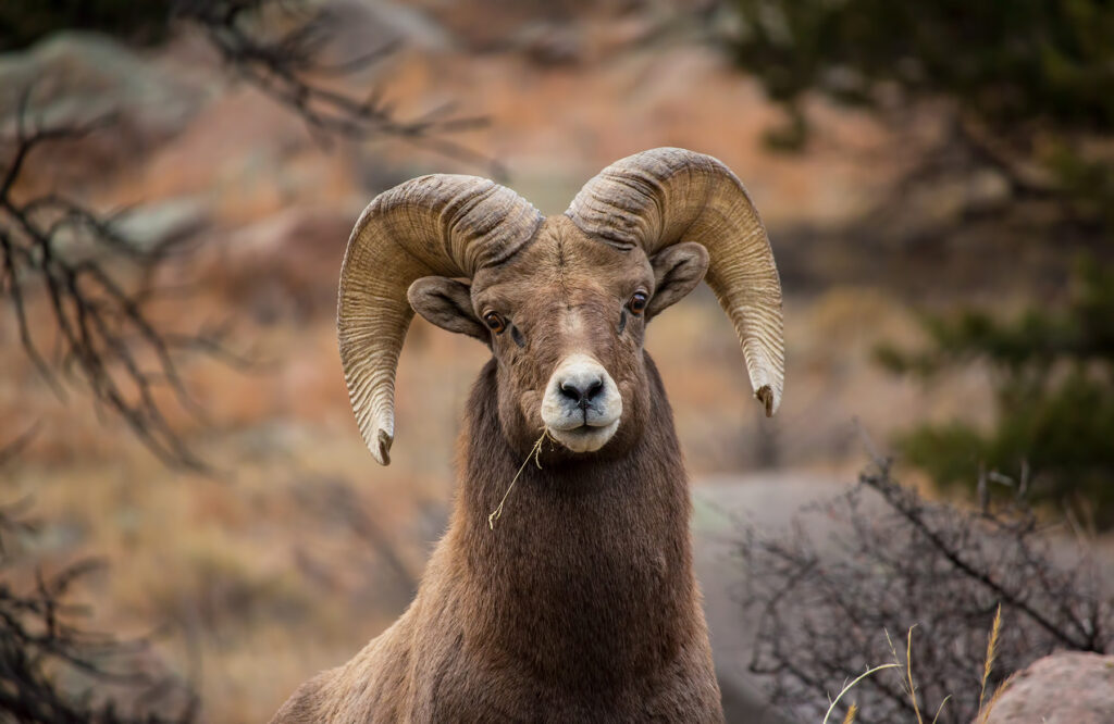
A variety of wildlife makes their home in the surrounding area: grizzly bears, black bears, mountain lions, big horn sheep, wolves, coyotes, deer, eagles, and elk.
You are in bear country, so take bear spray with you and know how to use it. Always be bear aware. I’ve hiked the trail countless times and have only encountered birds and deer. However, this does not mean other wildlife is not nearby. One summer, a sow and her cubs frequented Woodbine Campground. I never saw her, but many others did. The bears are there, so be aware of your surroundings. Always be safe and respect the animals. The forest is their home.
Seasonal Information
The trailhead for the Woodbine Falls Trail is within Woodbine Campground. This campground is open from early May to mid-September. Outside these dates, it is allowed to walk through the campground and access the trail, though camping is not allowed outside the permissible dates.
Directions to the Trailhead
Driving Directions:
From 1-90 at Columbus, MT, go 14 miles south on Highway MT-78 to Absarokee. Go 3 miles, turn left (west) onto Nye Rd. (MT-419), continue 20 miles to Nye, then 7 miles to Woodbine. Past the Stillwater Mine, you will see the Woodbine Campground on the left. Turn here and drive to the back of the campground to find the trailhead. Woodbine is 43 miles west of Billings, Montana.
There is a small parking area at the trailhead and outhouses with vault toilets in the campground. If the campground is closed, park at the gate and walk in to the trailhead.
Hiking Woodbine Falls Trail
Pros: Beautiful and easy hike with an impressive waterfall. Family friendly, memorable hike.
Cons: Moderate traffic and it can be crowded. Campground can be full.